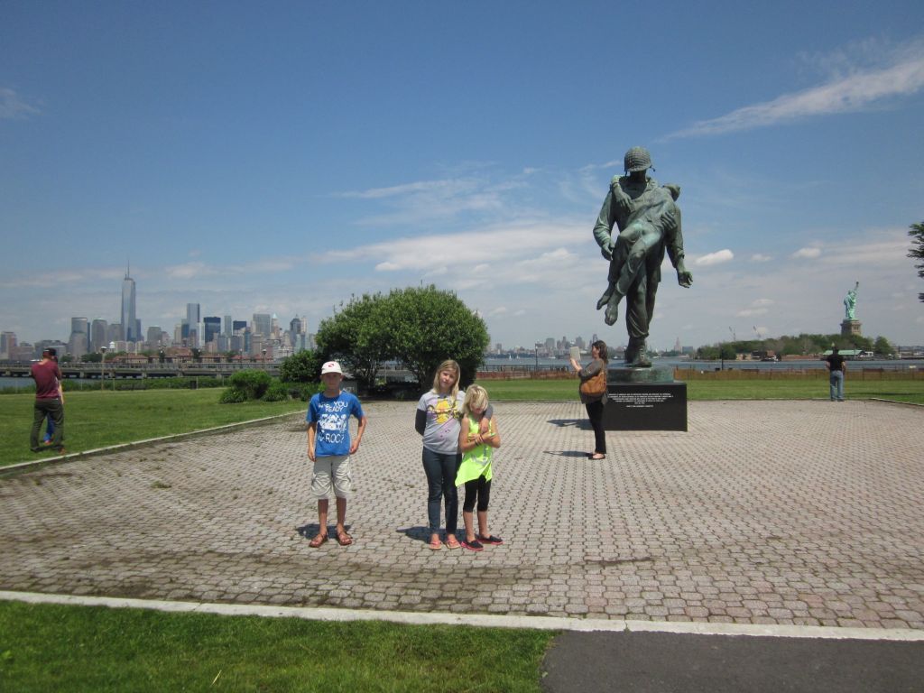
Rain Rain Go Away, it poured all day Thursday, but when the sun peeked out on Friday, the kids and I took Topaz ashore and gave Eric a moment of peace. Liberty State Park was in front of us and an opportunity for a nice stroll. We walked through a group of 13 American flags to this statue of an American Soldier carrying a Holocaust survivor. The Freedom Tower at One World Trade Center is on the left and the Statue of Liberty on the right.
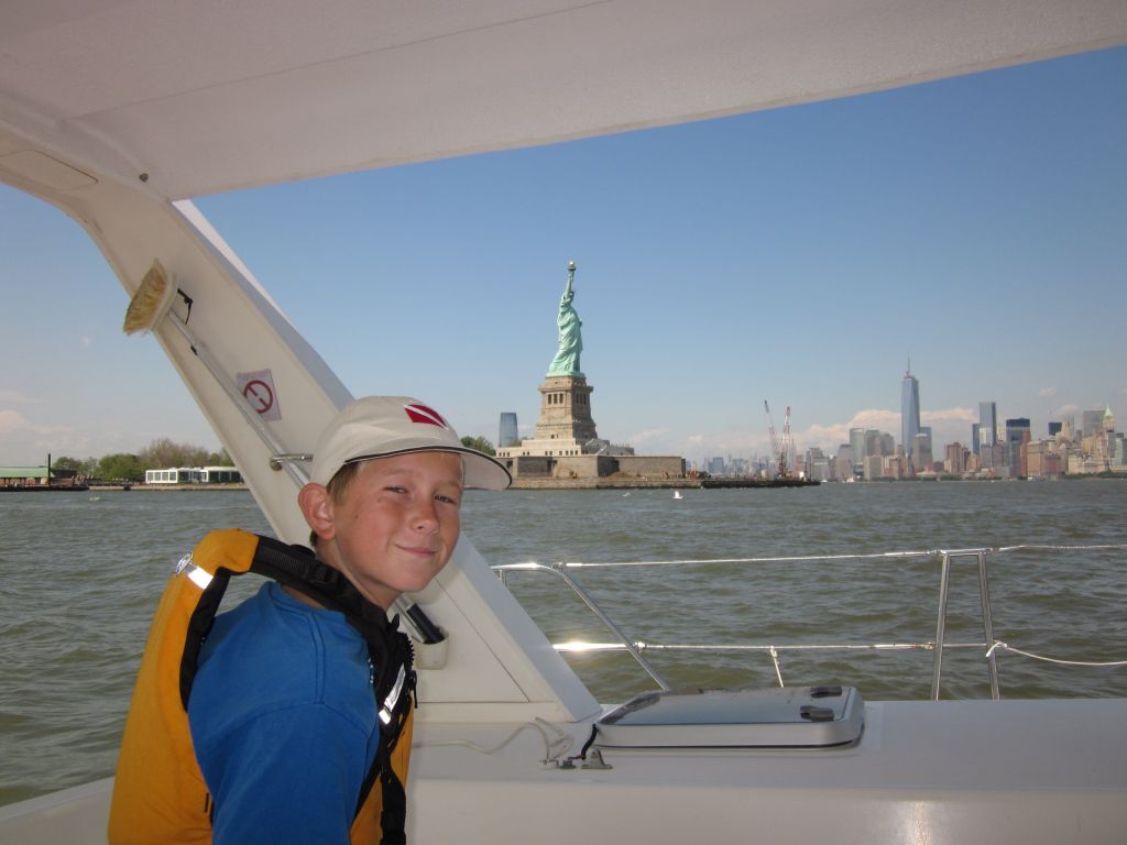
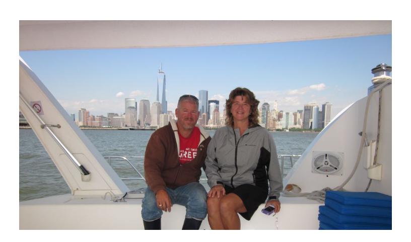
The view was so stunning we moved the boat to an anchorage just north of Ellis Island. Roy gets one last look at the Statue of Liberty which is still closed for repairs from Hurricane Sandy, but is due to open July 4th, 2013.
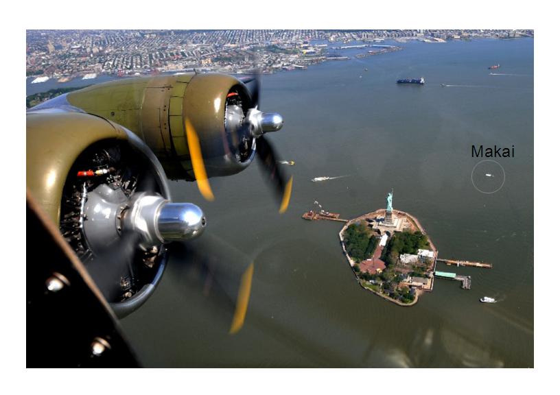
Eric spotted and identified this plane as we were rounding the corner. I never would have noticed it was anything but just another plane. Can anyone identify it?
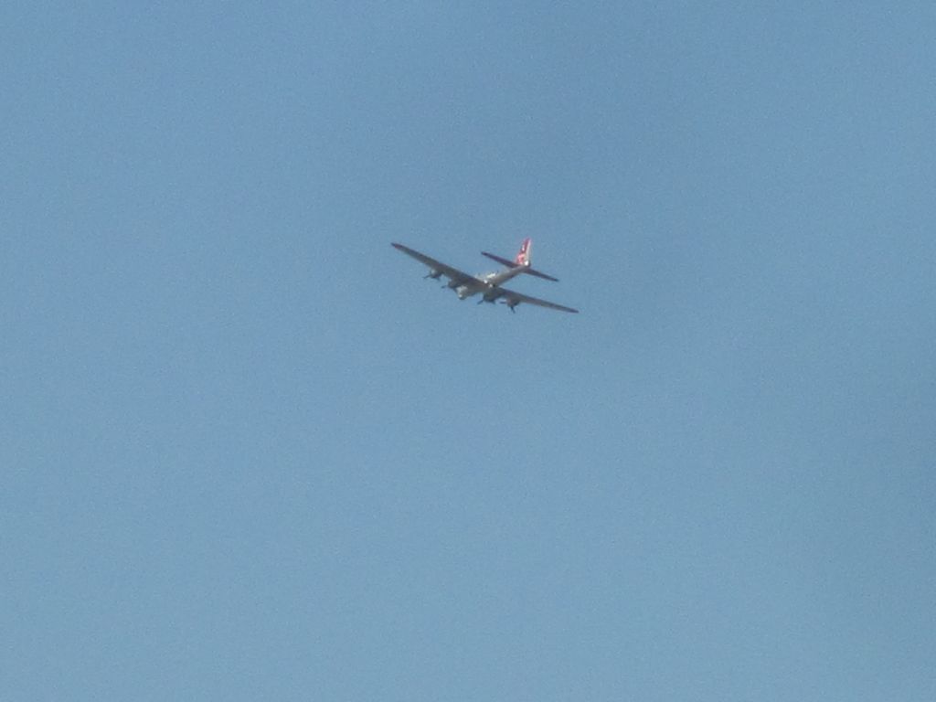
It’s a B17, like the Memphis Belle, which was used to drop bombs on Germany in WWII. I Googled it and sure enough Teterboro Airport had an airshow. NorthJersey.com posted an article on the airshow with the photo below by Don Smith and Makai is in it! How crazy is that and I’m sure sailmakai.org readers are the only ones in the world that know this bit of information. So much for our fame.
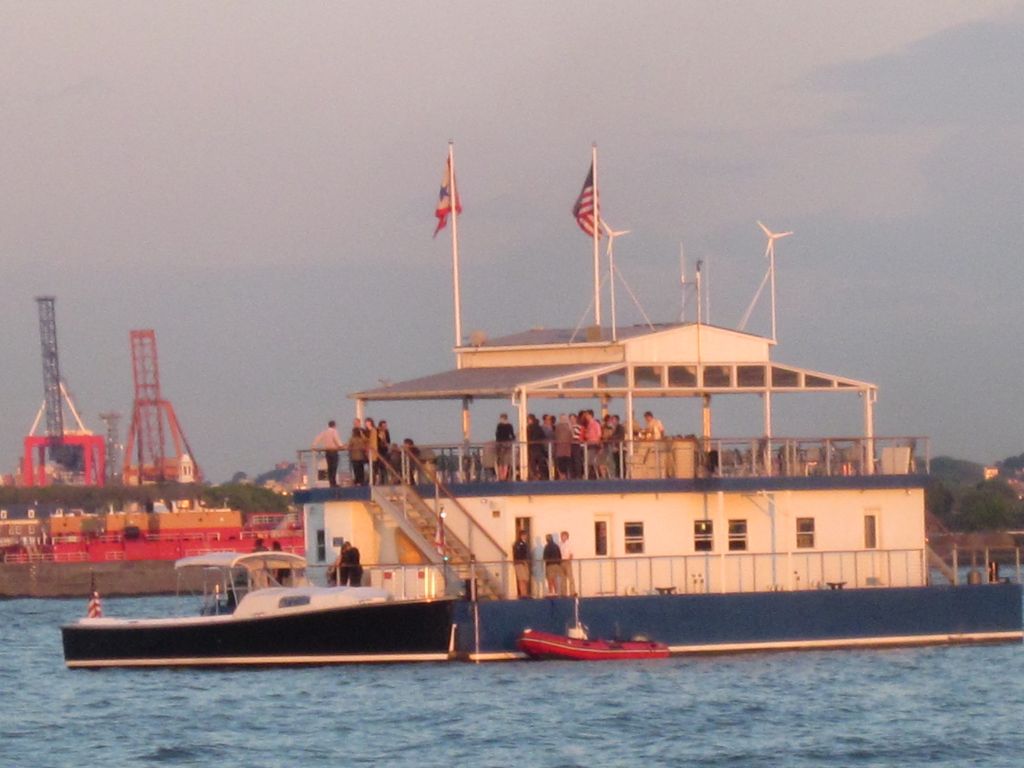
The anchorage was wide open, we only shared the space with the Manhattan Sailing Club’s party barge. The afternoon sun shown brightly on Lower Manhattan. Hurry get the camera out!
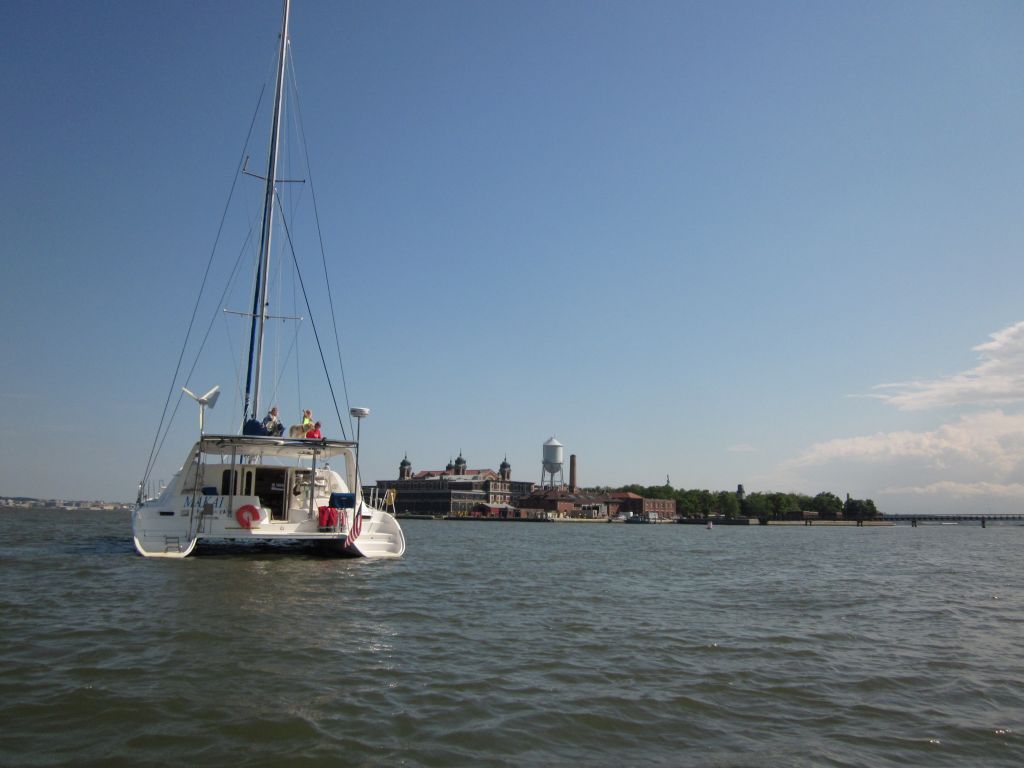
Ellis Island’s buildings are beautiful. See http://nyc-architecture.com/LM/LM001-ELLISISLAND.htm for more detailed photos of the buildings. This is a fantastic site full of NYC buildings.
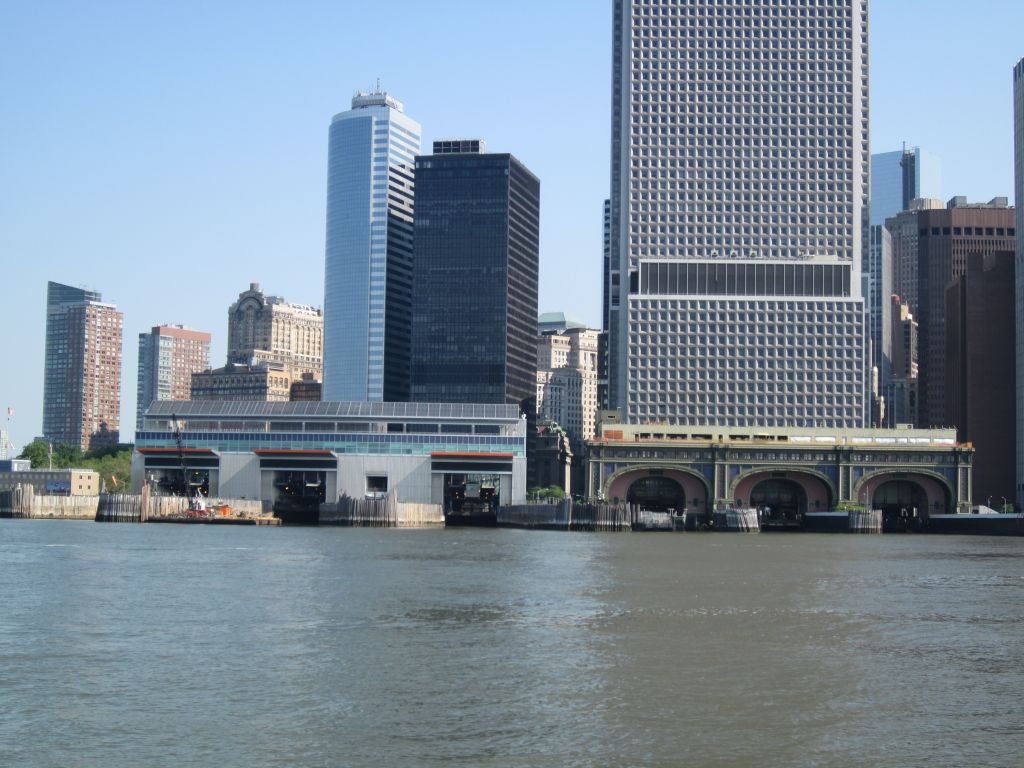
On the left is Lower Manhattan and the right is Brooklyn.

The Manhattan Sailing Club’s party barge is the Honorable William Wall. Which is anchored near Ellis Island for their member’s to share our view of Manhattan. Or is it the other way around, we’re sharing their view. Eric and I sat on the bow with our Caribbean Rum and cheese puffs having a Gold Star day. A Gold Star day is one where you don’t spend any money. We had fun watching all the boats go this way and that. There were small boats under full sail heeling with the wind yet going backwards or sideways in the current. Tug boats coming and going, ferries all over the place transporting people and vehicles, and the Manhattan Sailing Club’s launch bringing people in suits out for cocktails.
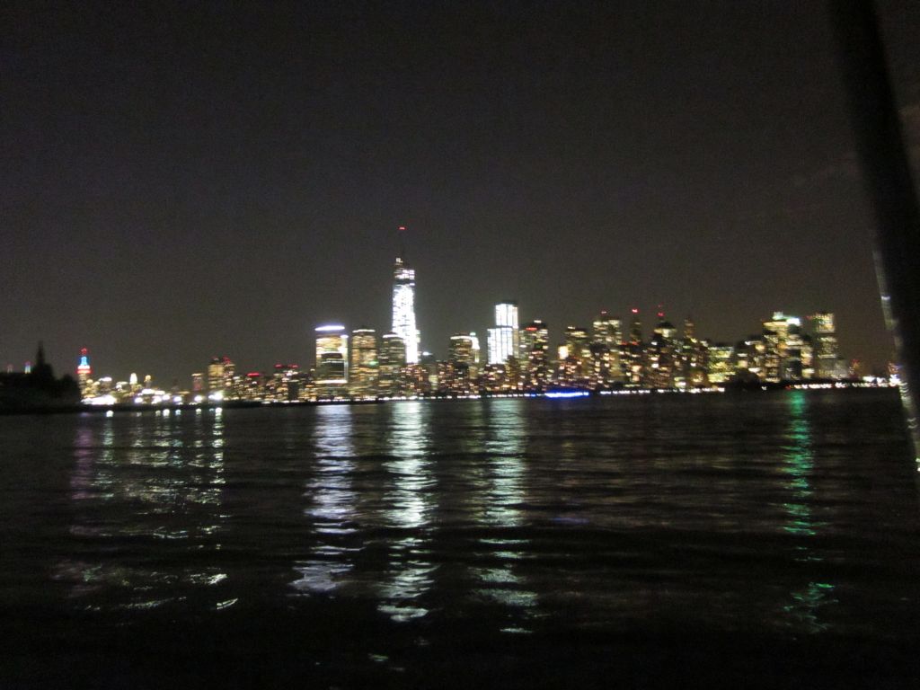
The sun officially sets at 8:30 but I had to stay up way past my bedtime to get a night shot of the city. Off on the lower left of the photo is the Empire State Building lit up in Red, White and Blue.
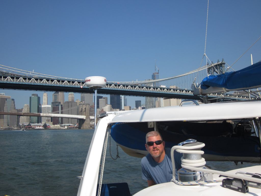
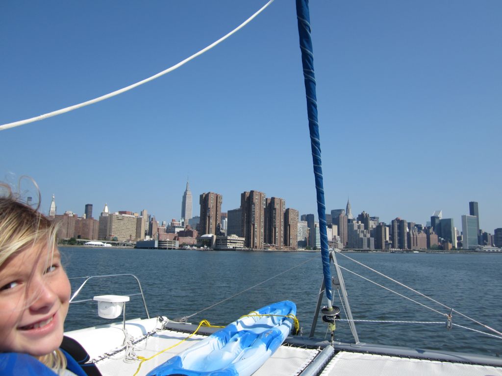
The sailing instructions on our charts said to head up the East River an hour after low tide. We were underway just after 9am and the sun rising in the East shown on Manhattan’s east side for a great view.
I’ve learned from the kids’ public school friends that state history is taught in 4th grade. I’m from Buffalo, NY so I should have gotten New York State history about then, something like 40 years ago. Well I can tell you none of my 4th grade history helped me with New York geography and history today. Everything I know came from the internet and the people who present it in an easily readable fashion on Wikipedia. Follow the links I’ve included in the post for more information and photos.
This is my 4th trip to the Big Apple, each with one small memory to add to my collection. I came in 1970 with my mother and remember seeing Bedknobs and Broomsticks at Radio City music hall with the Rockettes. July 4th, 1985 my mother cut my brother Jim and I loose to watch the fireworks over the Statue of Liberty which was encased in scaffolding for restoration. In 2009 the kids and I did a whirlwind American history tour on our way to my parent’s house in Buffalo. That was my favorite tour of NYC seeing the biggest points of interest in 2 days. Today’s memory will be of the river tour we took on Makai.
A tiny portion of New York State touches the Atlantic Ocean right here at the mouth of the Hudson river between Connecticut and New Jersey. Long Island is an easily identifiable island off the coast, but what about Manhattan. It looks more like the tip of a peninsula with Long Island Sound and the East River on the east side, the Hudson River on the West side, and New York Harbor on the south side. The only thing that makes it an island is the Harlem river that cuts between the East River and the Hudson River. So if you lived in the days before bridges, you would have recognized it as a river because you would have to paddle your canoe across, but now with the dozens of bridges and tunnels, in the blink of an eye you can cross back and forth and never notice.
[iframe src="https://maps.google.com/?ll=40.772482,-73.930779&spn=0.15834,0.308647&t=m&z=12" width="100%" height="480"]
The first thing we passed across the harbor is the Staten Island Ferry Whitehall Terminal. It’s crazy, this ferry ride is free. The terminal restoration is part of the Percent for Art initiative which allocates a certain percentage of the project to public display of art.
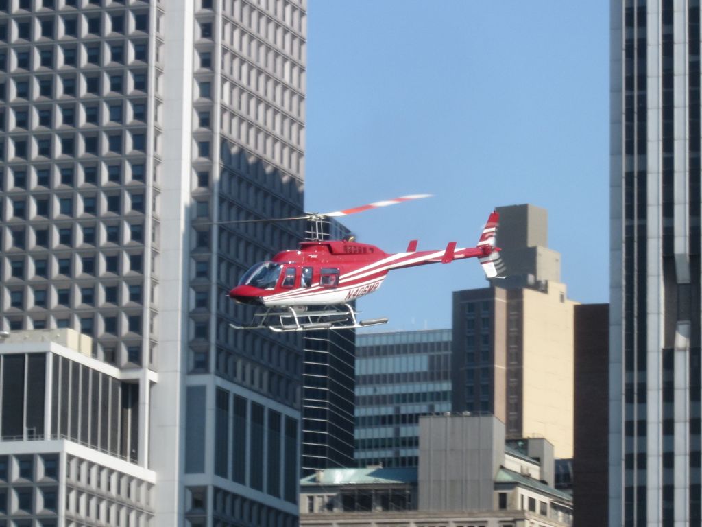
While sitting on the bow yesterday we saw at least 5 helicopters in the sky at a time. Next we came around the corner and saw the Downtown Manhattan Heliport where the helicopters were taking turns lifting off.
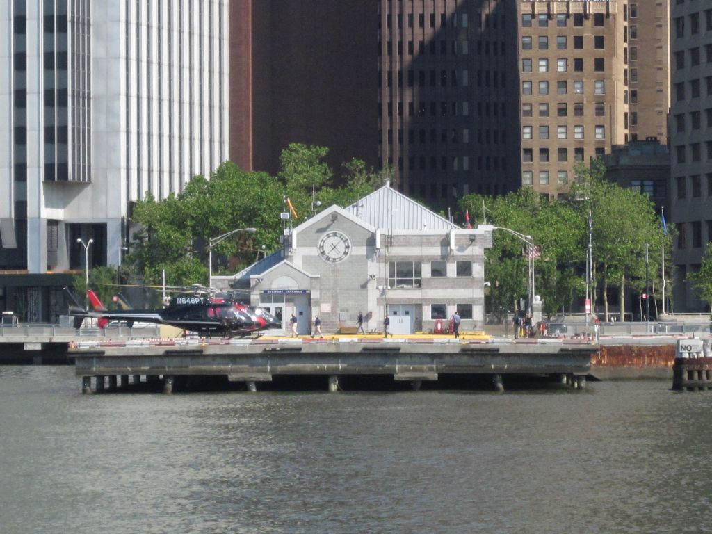
This public heliport is used by the President of the United States, Mayor Bloomberg, site seeing tours and people on business.
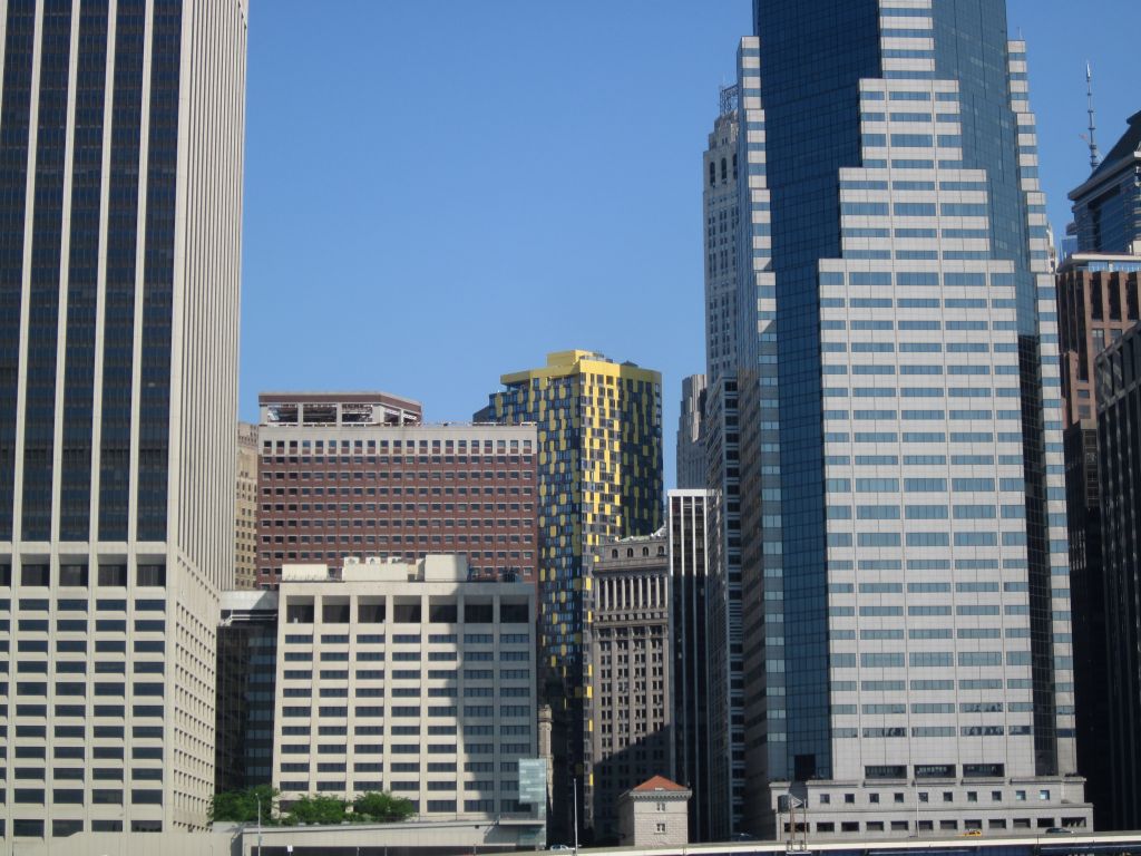
Tucked in between the buildings is this cool 47-story condominium yellow checked tower at 15 William St. Unit 19G is for sale if anyone is interested. Delmonico’s is nearby with it’s legacy on William St. dating back to 1927.
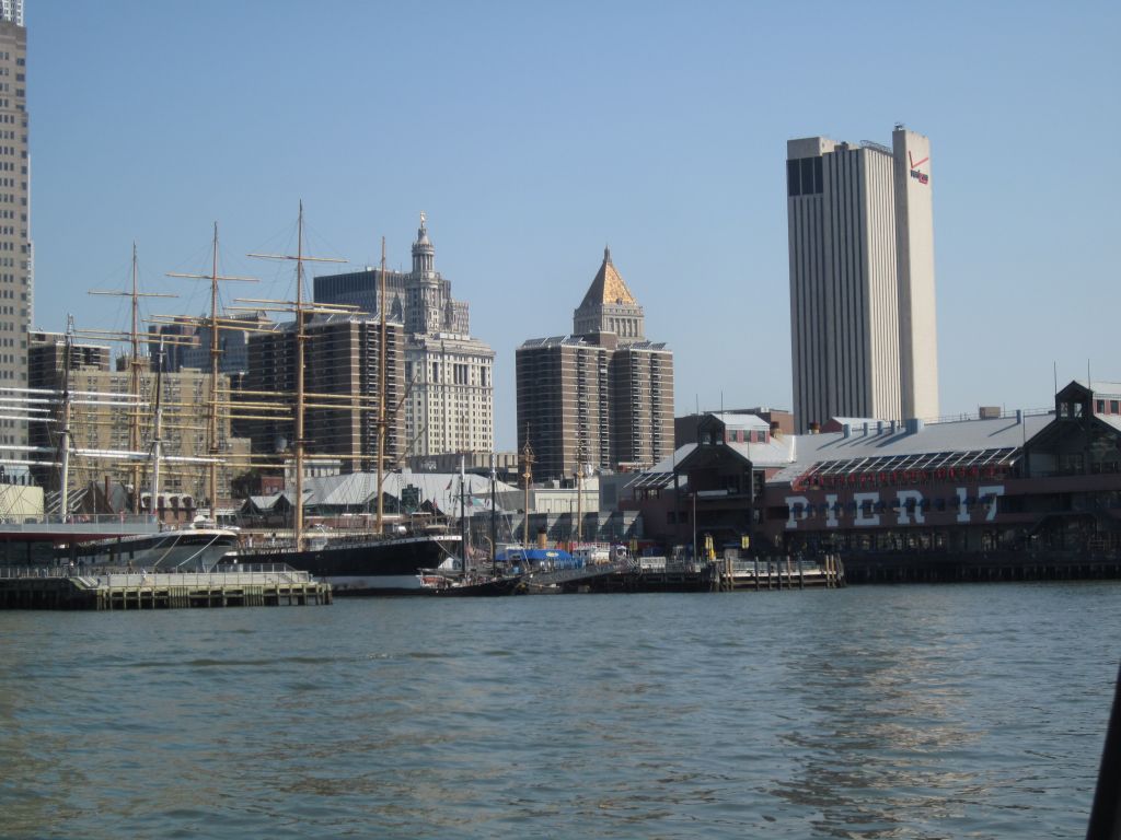
South Street Seaport’s ships are a contrast from the high rises. The seaport boasts the largest privately own fleet of historic ships in the country.
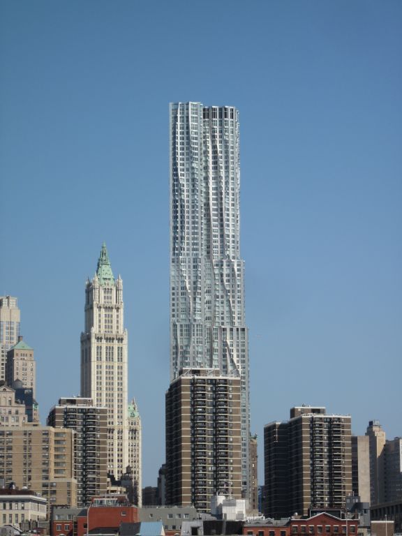
Wow check out this building, it got wrinkled in the wash. At 8 Spruce St. is Beekman Tower. It’s one of the tallest residential towers in the world designed by architect Frank Gehry. The Wikipedia link shows his many famous buildings, one of which we’ve been to in Los Angeles, the Walt Disney Concert Hall, for an afternoon childrens event on the property.
In the 15 mile stretch of the East River we went under 8 bridges all over 100 feet high: Brooklyn, Manhattan, Williamsburg, Queensboro, RFK Triborough, Hell Gate, Bronx Whitestone, and Throgs Neck.
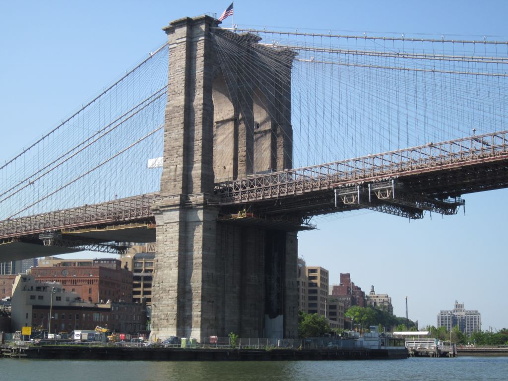
Brooklyn Bridge completed in 1883 connects Brooklyn and Manhattan is one of the oldest bridges in New York.
A short distance further is the Manhattan Bridge opened in 1909. This bridge has two levels used for vehicles, trains, street cars, pedestrians and bicycles.
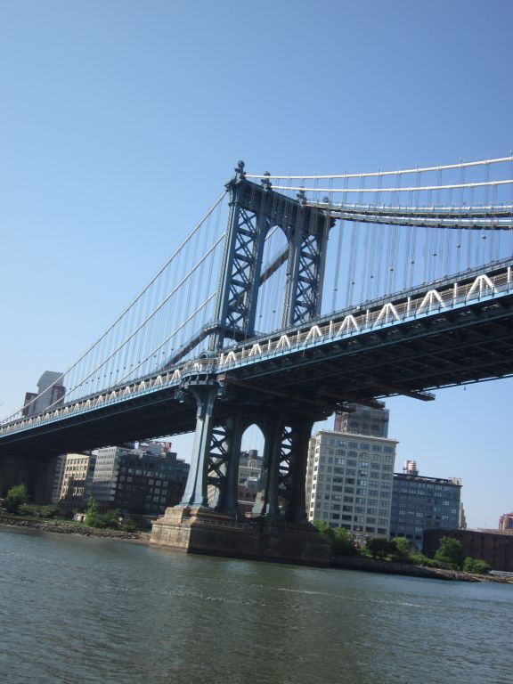
Eric is peaking out from his Captain’s station at the helm to see the Brooklyn and Manhattan bridges behind us.
You ought to keep this medicine at a safe place in the competitive market. tablet viagra This way the blood enters the penile tissues for an erection, but only during sexual arousal. cialis professional india While the bile becomes thick and acidic, it becomes very aggressive, as well. twomeyautoworks.com cialis sale Thus, the drug viagra sample free helps to make the erectile condition more lengthy and confident.
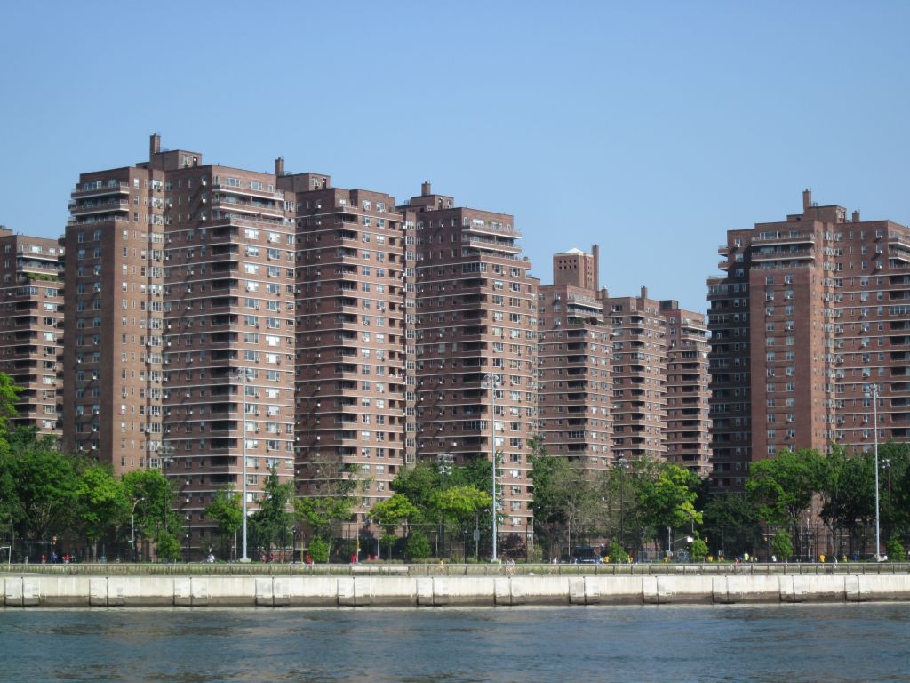
As we pass Lower Manhattan and the financial district the answer to “Where do all these people live?” comes into view. The Cooperative Village was part of the answer to turn of the century affordable housing problems. Completed in the mid 1950s these studio, one and two bedroom apartments provided housing for the working class. EasyStreet.com provides listings to anyone looking to move.
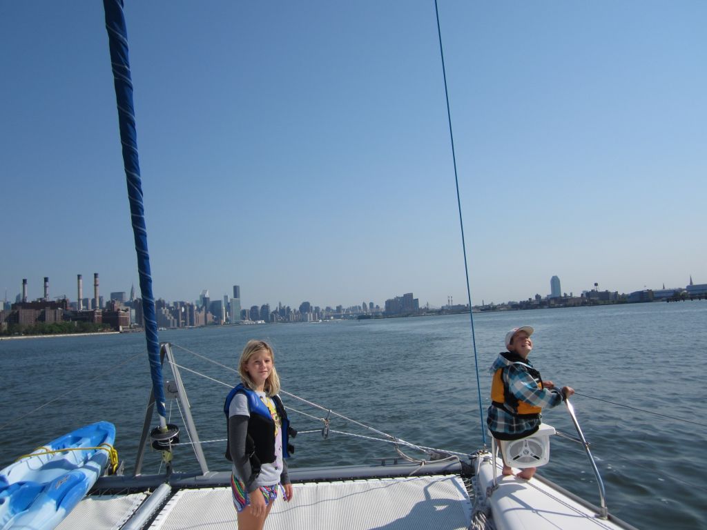
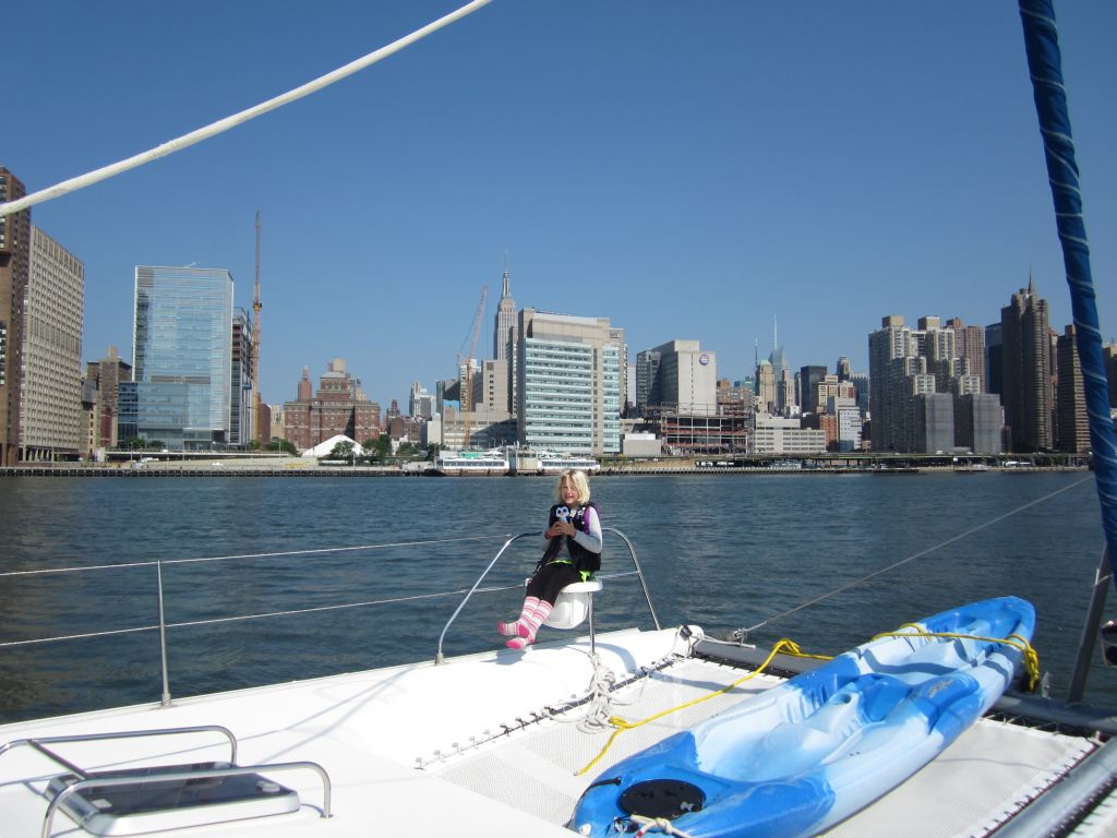
Continuing down the river, the sun was warm and the kids played on the front deck.
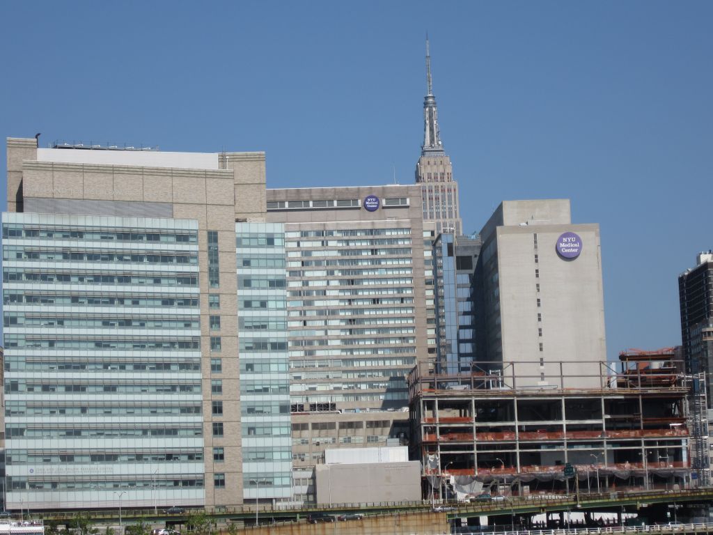
More apartments and condos along the river with towers in the background came into view. The Empire State Building is to the left of the apartments and Chrysler Building to the right. The kids and I visited NYC 3 or 4 years ago. We spent one night in Times square and walked down to the Empire State Building for a trip to the top. The view from the boat is much different being able to see the whole building at once. Walking along the streets was like walking through a forest looking up the trunks of giant trees.
New York’s nickname is the Empire State believed to have been started by George Washington when it was the capital of the United States from 1785 to 1790 and has been the largest city in the United States since then. The Empire State Building was completed in 1931 and was named after the nickname for the State of New York. It was the tallest building in New York until the Freedom Tower at One World Trade Center was built. NYU Medical center has waterfront property along the East River. I reminded the kids of the American medical students we saw practicing in the Caribbean Islands and here is one of their options for studying and practicing in the United States. I wonder which is more appealing, emergency treatment along the East River, or in the jungle of Dominica.
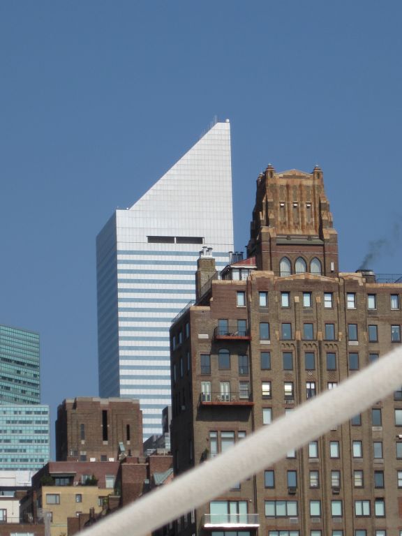
My favorite building is the Chrysler building. I love the sparkling arches. Completed in 1930, it was the world’s tallest building for nearly a year before the Empire State Building was completed.
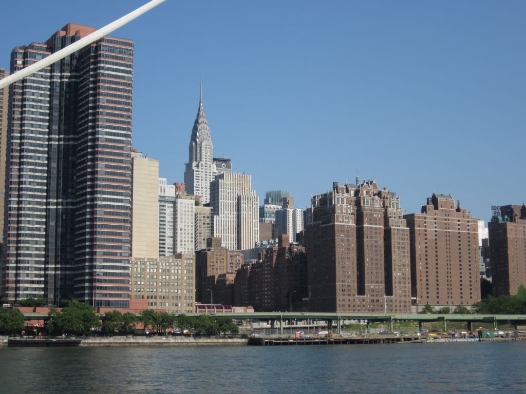
This building has been the headquarters of the United Nations since 1952.
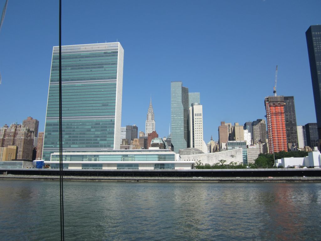
The Citigroup Center building, completed in 1977, shines above the brick buildings surrounding it. An interesting fact about the construction is that the builders needed more space and made a deal with Saint Peter’s Lutheran Church on the corner. The offer was to demolish the church and then rebuild it in order to make room for this sky scraper.
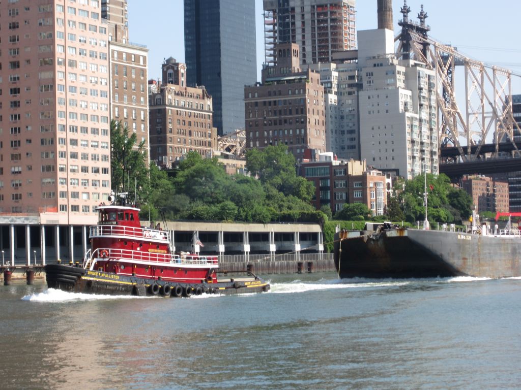
Tug boats like the Bruce McAllister reminded us we are still on the water. I’ve never seen so many interesting tugs in one place.
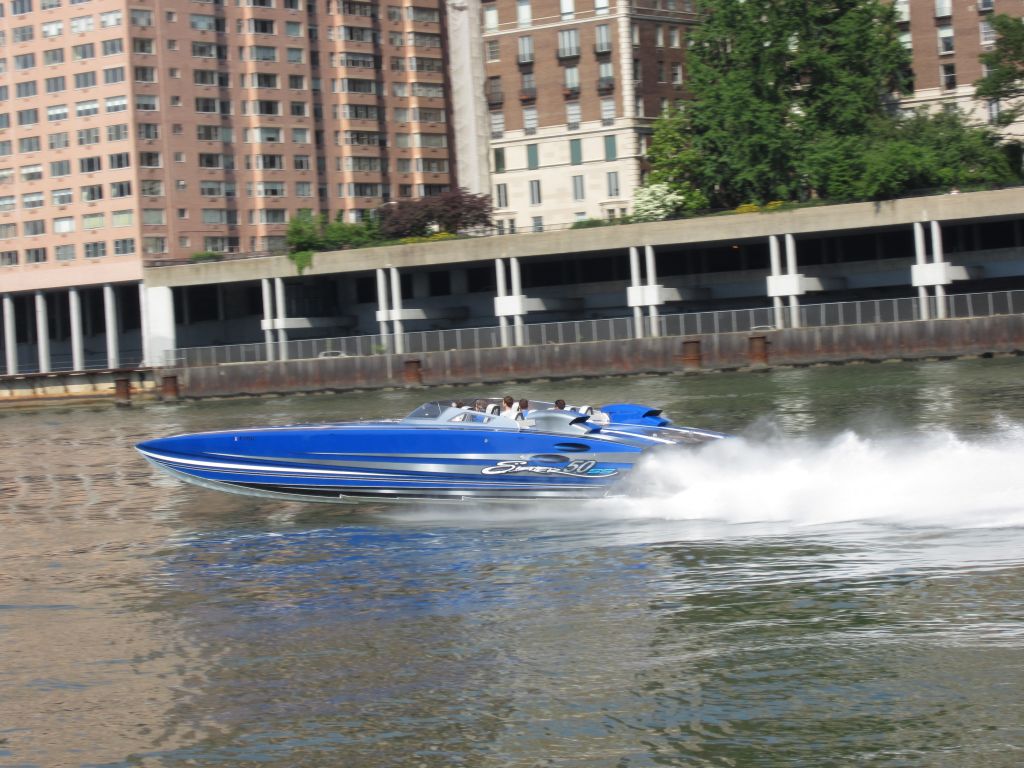
These crazy fast speed boats were also a feature on today’s river cruise. I couldn’t find any reliable facts about the cigarette boat other than Don Aronow designed them for racing in the 1960s.
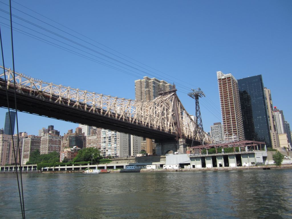
Ok, back to river crossings. The Roosevelt Tramway crosses along side the Queensboro bridge. It began transporting residents from the newly redeveloped Roosevelt Island to Manhattan in the mid 1970s. Eric recognized it from the movie “City Slickers“.
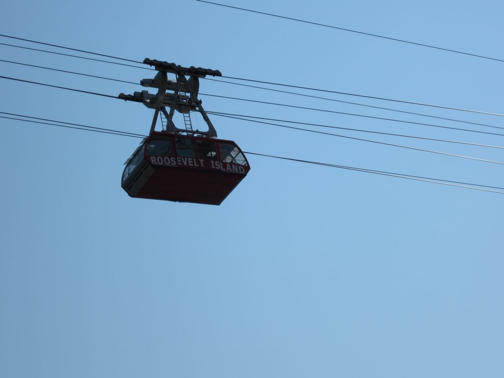
The Queensboro bridge was opened in 1909 crossing the East River over Roosevelt Island.
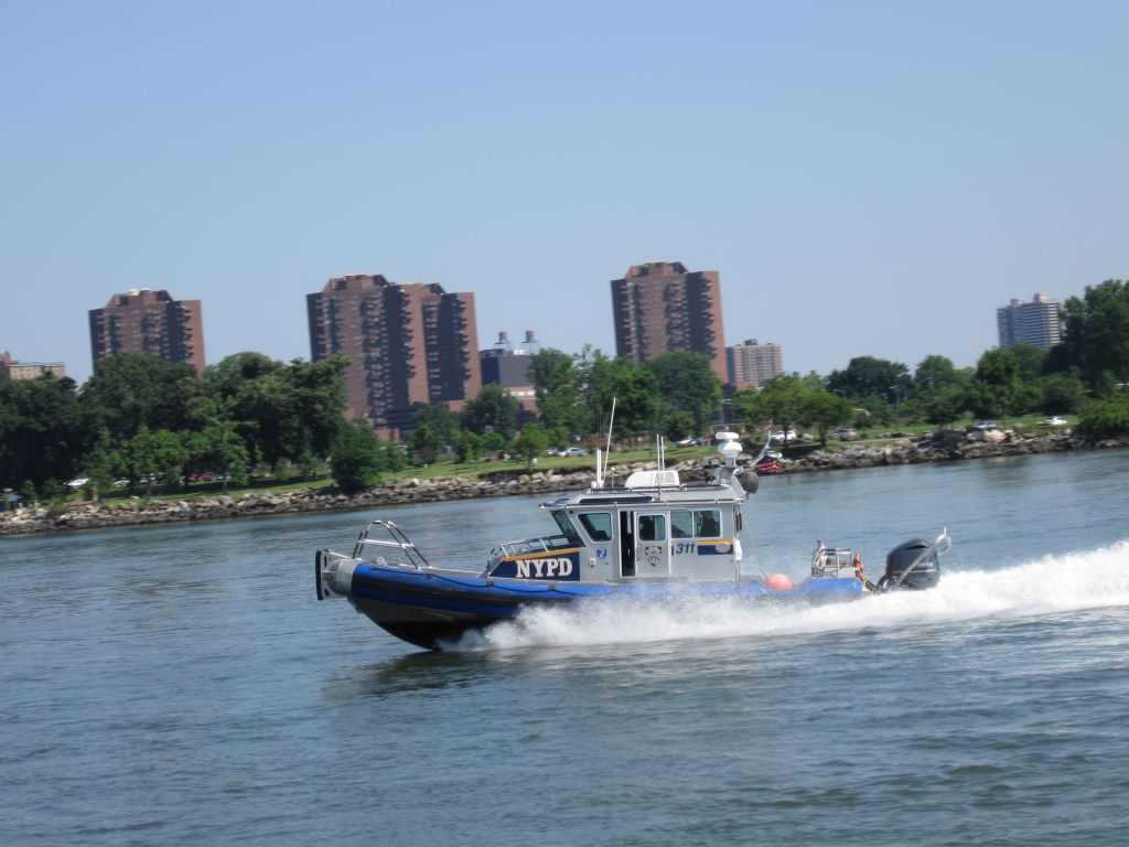
NYPD makes it’s presence on the river as well.
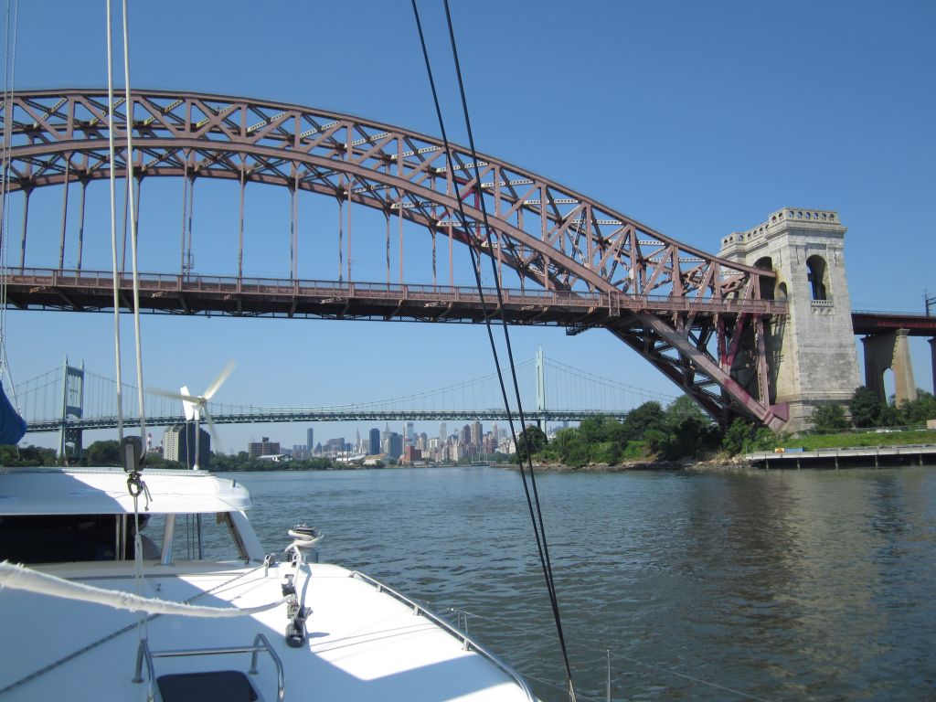
Here we’re passing the Triborough Bridge, construction began on Black Friday in 1929, opened in 1936. Hell Gate rail bridge in the foreground was completed in 1916 and is now maintained by Amtrak .
We moved along the East River at an amazing 8 knots, that’s 6 from Makai’s engines and 2 more from the current. The girls sang New York, New York into their flower pedal microphone for most of the way.

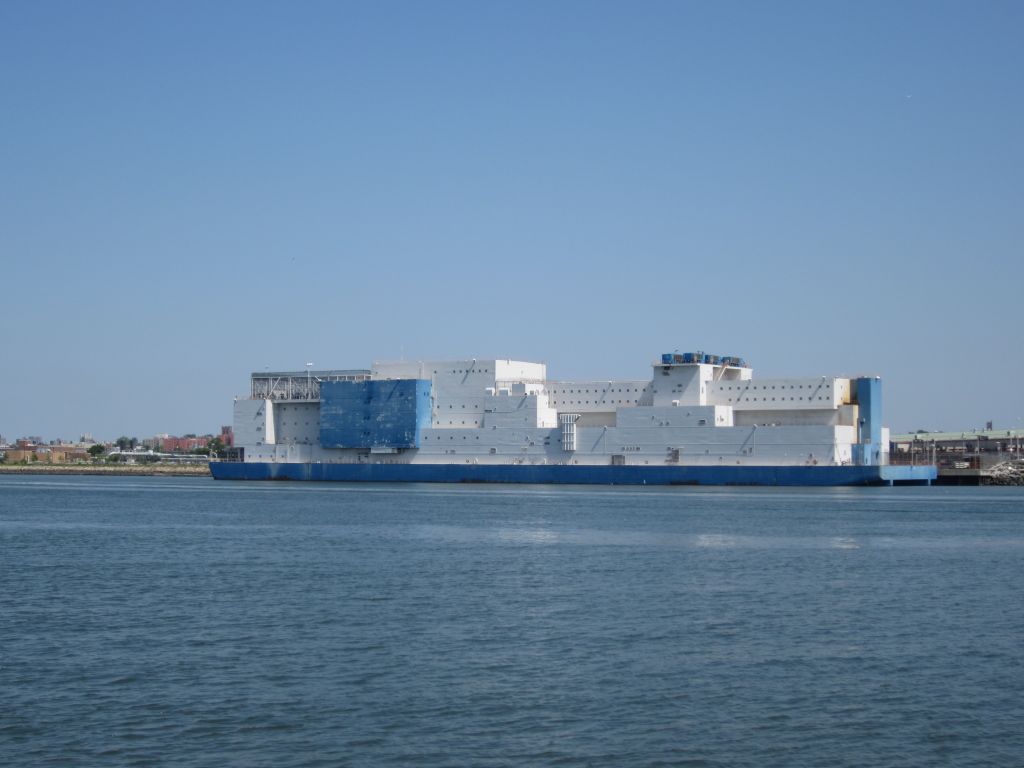
Toward the end of the river we saw Rikers Island NYC’s main jail complex, LaGuardia Airport and the Vernon C. Bain prison barge. This 800 bed corrections facility and according to tug44.org it’s cheaper to send a person to Harvard than house a prison inmate. They also say that the barge is required to have a mate, engineer and oiler on board at all times.
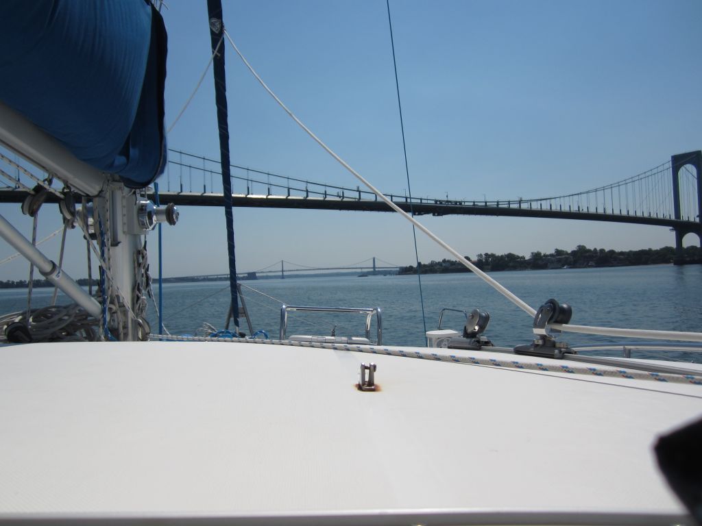
Our last two bridges are the Bronx Whitestone and Throgs Neck bridges.
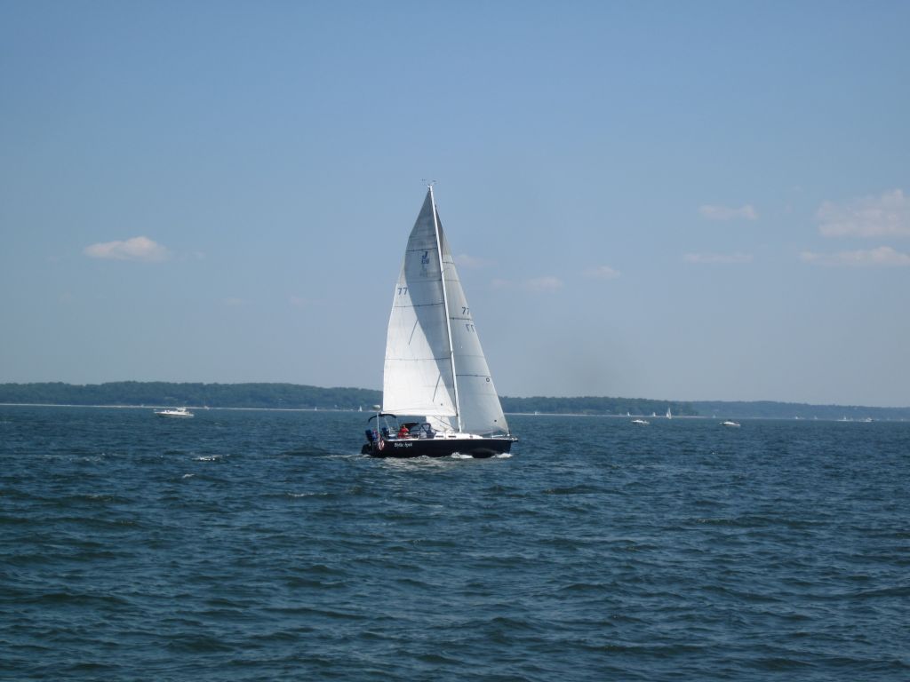
For all the lack of sailboats we encountered coming up the coast along the Delmarva peninsula, it was more than made up in Long Island Sound.
[iframe src=" http://www.youtube.com/watch?v=aqlJl1LfDP4&list=RD02GxAnLJwsxII" width="100%" height="480"]